Technology
P. Agnes has always been a leader in utilizing technology to improve processes and productivity in building construction.
As technology evolves, so does P. Agnes. We understand and have effectively implemented emerging technologies to save costs, improve efficiency, and increase the quality of construction projects on a consistent basis. We continue to build on our technology program, and a few examples of what we are currently doing are below.

Drones/UAV Systems
P. Agnes has been a leader in our market in the use of unmanned aerial vehicle (UAV) systems on construction project sites. With several FAA-certified pilots on staff, and various drone vehicles and equipment, we have the capacity and resources to utilize drone technology in a number of ways. Aerial imagery and data gathered from project sites are used for everything from site logistics planning and surveying to quality checks and inspections.
Drone use can provide unparalleled visibility into construction projects and provide highly accurate data for real-time decision making in a much safer and cost effective manner than methods using human labor.
")
Project Management Software
The benefits of creating a single source of accurate project data are clear: by efficeintly managing and sharing project information, we reduce errors and costly rework, and we improve communication between all project stakeholders by increasing speed and accuracy of data exchange. Providing a digital environment for collaboration with design teams allows for real-time problem solving, instead of a back-and-forth design/review approach. Additionally, managing the complete set of project documents throughout the lifecycle of the project, and providing that data through a mobile platform, puts the right information directly where it is needed.
")
BIM
Building Information Modeling (BIM) is one of the most powerful technology tools in construction. We have strategically developed our company’s master BIM Execution Plan, and have successfully implemented it in completing over $750 million worth of work.
3D models provide us with geometric and spatial relationships, which allows coordination of a complete system within available space and against adjacent work. It also allows our team to use real data properties to generate highly-accurate cost plans and project schedules. BIM allows us to build projects in a virtual environment to identify any potential design, constructability, or operational issues before real costs and the project schedule are at risk.
")
Laser Scanning & Reality Capture
Utilizing laser scanning and other reality capture techniques has benefitted a number of our projects and provides a faster turnaround, reduces labor costs, and enables us to add value to our deliverables. Having exact dimensional as-built models aids in performing both new construction or retrofit design projects, and reduces the time and costs associated with return site visits and rework due to dimensional errors.
The General Building Contractors Association (GBCA) selected P. Agnes as the winner of the 2023 Excellence in Technological Advancement Award as part of their Construction Excellence Awards program. Our organization received this same recognition back in 2020, and in those few years, our technology program has continued to evolve even further. This recognition is a true testament to the hard work our employees devote to understanding, adapting, and implementing new technology, and demonstrates our continuous dedication to technological advancement.
Technology News & Insights

Excellence in Technological Advancement: P. Agnes Technology Program Recognized by the General Building Contractors Association
P. Agnes is proud to announce the General Building Contractors Association (GBCA) has selected us as the winner of the Excellence in Technological Advancement Award as part of their 2023 Construction Excellence Awards program. Our organization received this same...
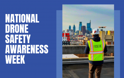
National Drone Safety Awareness Week: Steps for a successful and safe flight operation
National Drone Safety Awareness Week, held by the Federal Aviation Administration (FAA), reinforces safe flying practices by promoting educational information, success stories, technological advancements, and more. At P. Agnes, we utilize drone technology for a number...

Harnessing the Power of BIM & Digital Construction
Utilizing technology within the construction industry is something companies can no longer ignore. From January 25-29, Midwest Build Week held their virtual construction and design event which brought together thousands of industry professionals to learn about the...